AERIAL MEASURED SURVEYS USING DRONE TECHNOLOGY

Map, measure and model your buildings and structures with photogrammetry

Using the latest drone technology, we can accurately map and measure surfaces, distances, volumes and elevations – delivered in high-resolution orthomosiacs and 3D point clouds.

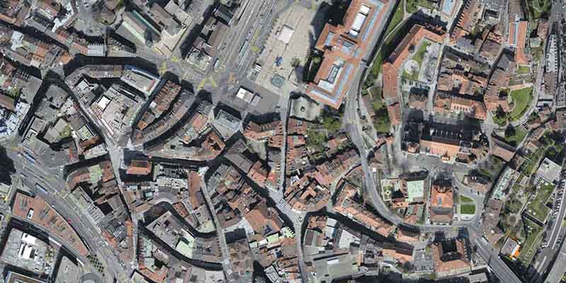
Orthomosaic 2D Mapping

2D MAPPING

High-resolution orthomosiacs for large scale aerial mapping and measuring

.tif, .kml

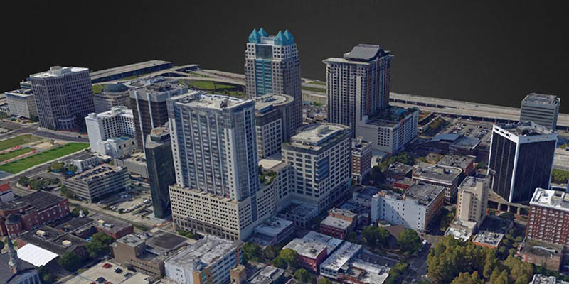
Drone 3D Modelling

3D MODELLING

Accurate 3D textured meshes as a quicker alternative to 2D drawings

.ply, .fbx, .dxf, .obj

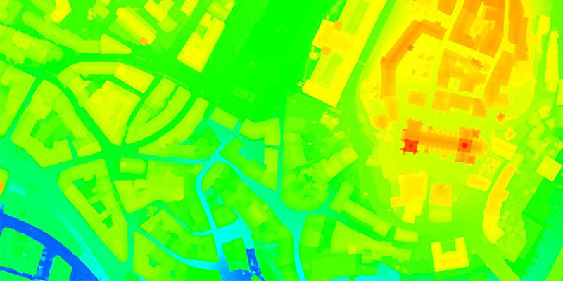
Digital Surface Models

DIGITAL SURFACE MODELS

Digital Elevation Models to capture both natural and built environmental features

.tif, .xyz, .las, .laz

TRUSTED BY OVER 2,500 CUSTOMERS

iRed® is trusted by everyone, from the UK Emergency Services and Fortune 500 companies, to local councils and those just starting out.

BBC Drone Training
Anglian Water Client
CAA Approved Drone Pilots

CAA APPROVED PILOTS

iRed® have been awarded a specialist 10m Operating Safety Case (OSC) from the CAA, enabling us to fly outside of the restrictions of standard drone operators.

WE STAND BY OUR WORK AS THE BEST IN INDUSTRY

Our team of industry experts help clients revolutionise the way they operate, utilising new and emerging sensors to reach their carbon reduction goals

102FT MAST

For congested areas (such as London), we operate a 102ft vehicle-mounted mast for total coverage.

LARGEST DRONE TEAM

We’re proud to have the largest team of accredited thermographers and CAA approved drone pilots.

NATIONWIDE COVERAGE

We have accredited surveyors and qualified drone pilots based all around the UK, for total nationwide coverage.

MEASURED SURVEY FAQs

Photogrammetry is the practice of capturing 2D images and converting them into 3D models. Used for surveying and mapping, photogrammetry surveys allow for accurate measurement between objects. This is ideal for:

  • Creating land registry maps
  • Accurately measuring buildings
  • Monitoring rock and ground formations
  • Mapping and modelling heritage sites
  • Mapping accurate field boundaries
  • Measuring, managing and monitoring site stock

Using specialist drones, we’re able to create accurate 3D models to monitor construction and manage site stock as part of BIM (Building Information Modelling). We have a large fleet of aerial platforms, ranging from DJI Enterprise drones to bespoke systems specifically created by our technical team for individual projects.

To capture reliable data on-site, we only use the highest-resolution visual cameras available to the commercial market. This varies from 36 megapixels to 400 megapixels, depending on a project’s requirements.

Our drone operators follow strict workflows to capture quality data on-site. A basic measured survey has 4 stages:

1. Flight Planning

As soon as a brief has been set by a client, our engineers will begin planning the project for all aspects of safety. This includes:

  • Checking and verifying site suitability
  • Obtaining permissions for drone operations
  • Planning ground control points for accurate data collection
  • Establishing a ground-based approach for data collection (if required)

Our CAA Approved drone operators will then use flight-planning software to map out a site flight-path.

2. Data Collection

After arriving on site, our team will setup a monitoring station to conduct operations from. The station will enable our pilots to monitor the quality of data captured during flight. It also allows for light processing on-site for data validation.

Once complete, our pilots will setup and deploy a specialist drone. Equipped with a high-resolution sensor, the drone will begin capturing visual data for the entire site.

3. Data Analysis & Processing

Using the data collected on site, our team will start to process the aerial images using specialist software. During the processing, an engineer will be on-hand to refine and optimise the quality of outputs. This ensures that high-quality orthomosiacs and photo-realisitic models are created.

4. Project Output

Within 7-10 days* of survey completion, clients will receive:

  • A Project Summary
  • Project Object File (.obj)
  • Project Shape File (.shp)
  • Point-Cloud Files (.las, .laz)
  • High-Quality Visual Orthomosiac (.tiff)
  • Geographic Information System (.kml, .kmz)

Depending on requirements, we can also provide online viewing software for the final outputs.

*Depending on initial project requirements

READY TO
GET STARTED?

Let’s talk about your business goals